Perranporth to St Agnes Walk
The walk from Perranporth to St Agnes is a stunning coastal hike along the South West Coast Path in Cornwall. It’s a relatively short but rewarding route, covering about 4.5 miles (7.2 km).
Depending on your pace and time spent at various stops, it takes an estimated time of 2½ to 3½ hours.
Here’s what you can expect:
Difficulty:
The path is classified as moderate. It does have some steep ascents and descents, but the path is well-maintained.
Weather:
The weather in Cornwall can change rapidly, so you must be prepared with appropriate clothing. Sturdy walking boots or shoes are recommended as the terrain isn’t suitable for flip-flops!
Refreshments:
There are plenty of cafés and pubs in both Perranporth and St Agnes. Why not try a Cornish pasty or some local ale?!
Detailed Route Description: Perranporth to St Agnes
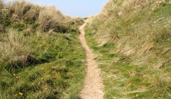 Path to Perranporth
 Perranporth Millennium Sundial
Starting Point: Perranporth Beach
Hop on the bus from St Agnes to Perranporth, a lively seaside town known for its expansive sandy beach, and head to the car park just above the beach. From there, take the lane uphill, passing the Seiners Arms and Atlantic House Hotel. Look for a path on your right, marked by three metal poles, which leads to a grassy area.
Bear right off the lane and follow the path along the fence to the Perranporth Millennium Sundial. Follow the fence until you come to a track that leads to the cove straight ahead. To your left, you’ll spot a waymarked path leading to a flight of steps. head up the steps and continue along the lane as it climbs uphill, with Droskyn Castle on your right, until you reach a junction marked with a waymark.
At the junction, turn right onto the lane marked “Droskyn Point” and stay to the right. Follow the lane until it ends at a gate with a “YHA” sign. Go through the gap beside the gate, and continue along the lane past the Youth Hostel. When the lane ends at a pair of double gates, take the waymarked path branching off to the right.
Keep right onto the waymarked path and follow it past a waymark at a path junction. Continue through a gap in the wall to another waymark at a junction, marked with multiple yellow arrows. At the waymark, stay right along the coast and follow the path until it concludes at a flight of steps leading up to another trail.
Climb the steps and veer right onto the path. Continue along it until you reach a waymark where the path crosses over a wall. Cross the wall to the right and follow the waymarked path through the mine tips and along the headland until you arrive at a waymark labeled “Cligga.”
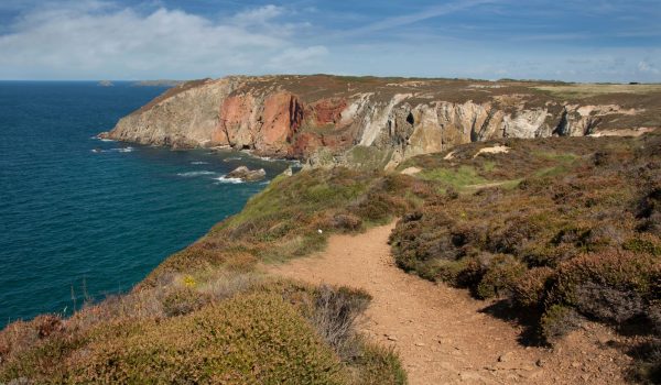 Cligga Head
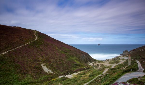 Trevellas
Follow the path along the coast, marked for Cligga, until it passes through a quarry at the tip of the headland and reaches a waymark with views overlooking the coast. At the waymark, turn left and follow the path uphill. Continue along the coast path until you reach a plateau with concrete remains. Pass these remains on your left, then continue until you reach a final concrete platform, with paths branching off to the right.
Turn right, follow the path down into a gully, and continue until you reach a fork in the path. Take the right-hand path and continue until it passes through a line of posts and splits again. Follow the waymark to the right, leading into the gully—note that the other path is prone to flooding. Proceed to a waymark at another path junction, then continue a bit further to a fork marked with a sign reading “Unstable Cliff – Please Keep Clear.”
Take the left-hand path to keep back from the cliff edge and continue following the path to where a path departs to a large capped mineshaft on your right. Continue on the left to follow the Coast Path uphill. Keep going until you reach a junction of paths beside a picnic bench.
Stay to the right on the coastal path and follow it for some distance until you come to the remains of an airfield. Here, the path crosses a stretch of tarmac and leads to a waymark. From this point, bear left across the tarmac to find an unsurfaced path marked by another waymark on the opposite side. Follow this unsurfaced path to a fork, indicated by another waymark. Take the right-hand path marked for the coast path. Continue past the mound and a waymark until you reach a junction of paths at a second waymark.
Follow the coastal path, crossing an area of exposed rock, until you reach a waymark next to a wooden fence. From there, continue a short distance along the path to where a trail branches off to the right, just before another waymark. Turn right and proceed to a third waymark at the top of a flight of steps. Descend the steps to arrive at the car park.
 Stippy Stappy Cottages
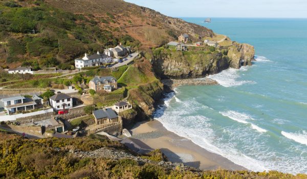
St Agnes
Head left along the top of the car park toward a waymark, then shortly after, turn right onto the path that passes between three small granite posts. Follow this path to a fork just before the chimney stack. Stay left to take the main path closest to the chimney stack and continue until it meets a tarmacked lane.
Turn right onto the lane and follow it a short distance up the opposite side of the valley until you see a Coast Path signpost marking a path that branches off to the right via a gate and stile. Keep to the right off the lane, crossing the stile beside the gate, and follow the path uphill. When the path opens up and splits, keep right at the fork. Continue along the path to a junction marked by a waymark with a sign warning of “unfenced cliff ahead.”
At the waymark, take the middle path straight ahead and follow it to another waymark where a path from the right merges back in. Bear left, continuing along the path beneath the mine tips, until you reach a junction just past two benches and a rock inscribed with Peterville and The Village. From the junction, follow the path along the ridge, passing through a wooden barrier, before it emerges onto a driveway.
Follow the driveway downhill until it meets the road. Turn right and walk a short distance until you see a track branching off to the left, just beyond “Woodlands.” Take the track and continue onto the path that climbs uphill past the row of cottages called * “Stippy Stappy.” The path then emerges onto the road.
Cross the road to the pavement opposite and head uphill toward the church. From there, cross the road to the St Agnes Hotel and follow the pavement on the right-hand side toward the bus stop. Continue a bit further to arrive at the car park on Trelawny Road.
In conclusion: Perranporth to St Agnes
This walk is mostly level, offering fantastic cliff-top views throughout. Along the way, you’ll get a chance to see the area’s mining heritage, all while enjoying the local birdlife and vibrant wildflowers. It’s also a great choice for dog owners, as the route passes by dog-friendly beaches and pubs where your furry friends are welcome.
* FYI: Stippy Stappy cottages are a row of historic cottages in St Agnes, Cornwall, that were built in the 18th century. They were originally built for ships’ captains, and they feature in all seven of Winston Graham’s Poldark books.


